2026
Urban Kickstart Award 2026
Feb 2026
The Aubrey Barker Fund is excited to announce that Dorraine Duncan, an urban planner and co-founder of Jamaica-based research think-tank Island City Lab, has been awarded the 2026 Urban KickStart Grant. Her research project aims to re-surface Jamaica’s history of communal land tenure systems with the goal of reintroducing them as viable instruments for sustainable land regularization, prevention of community displacement, and the safeguarding of affordable housing and livelihoods across Jamaica’s urban areas.
Instruments of collective land ownership/stewardship have existed throughout Jamaica’s history, protecting and providing affordable housing. Post-Emancipation, these tenure systems have effectively de-commodified housing and land by removing them from the emerging globalized real estate markets and prioritized collective needs over individual profit and macro-economic abstractions.
Over the next year, Dorraine will unearth the breadth of communal land tenure forms, explore how existing land tenure instruments have manifested in practice, and generate public discourse around the legitimacy of communal land tenure instruments as a solution to land regularization and affordable housing in the island. Whether it’s female housing cooperatives of the 70s, post-hurricane housing trusts from the 50s, or the semi-sovereign communal tenure of the Maroons, these examples offer valuable lessons on the legal and governance frameworks, social and political supports necessary for the mainstreaming of communal alternatives for the future.
The project will result in a number of reports, a peer-reviewed journal article, presentations at relevant conferences and events, and the development of a communal land practitioners’ virtual network.
The Urban KickStart Grant is a new initiative for the Aubrey Barker Fund, working with Geoffrey Payne of GPA Associates. The scheme aims to improve secure access to land and housing by supporting research and other activity which advances and disseminates knowledge and skills in land management and related disciplines. We will do this by providing opportunities for young graduates to undertake research or other assignments that can help meet the needs of vulnerable urban communities for access to land and adequate housing on affordable terms. Grantees will also receive mentoring from international experts with expertise relevant to the product scope and location.
(23rd February 2026)
2025
ABF-Funded Project Empowering Rwanda’s Next Generation of Land Professionals
Dec 2025
The Aubrey Barker Fund is proud to have funded GanzAfrica’s Land Survey Fellowship Programme in Rwanda, an initiative that strengthens land administration systems while building sustainable professional capacity.
Through ABF support, five Land Survey Fellows were trained and deployed to Rwanda’s National Land Authority, where they contributed directly to improving service delivery, reducing case backlogs, and supporting land dispute resolution. Within a year, the Fellows assisted in resolving the majority of land dispute cases received and supported thousands of land transactions across multiple districts—delivering tangible benefits for institutions and communities.
Iain Greenway, Chair of the Aubrey Barker Fund, said:
“We are delighted that GanzAfrica is one of the Fund’s Foundation Partners, and that we have been able to fund this vital work. The Fund is dedicated to enhancing sustainable survey and land management skills in developing countries through professional education and capacity building for the lasting benefit of local communities. The work that GanzAfrica has done in Rwanda is at the heart of our mission.”
Beyond operational impact, the programme has strengthened the link between education and practice by feeding field-based learning back into land surveying and land management curricula, helping to prepare future cohorts of professionals. This ABF-funded partnership reflects the Fund’s commitment to long-term capacity building that underpins fair, efficient, and trusted land governance systems.
(23rd December 2025)
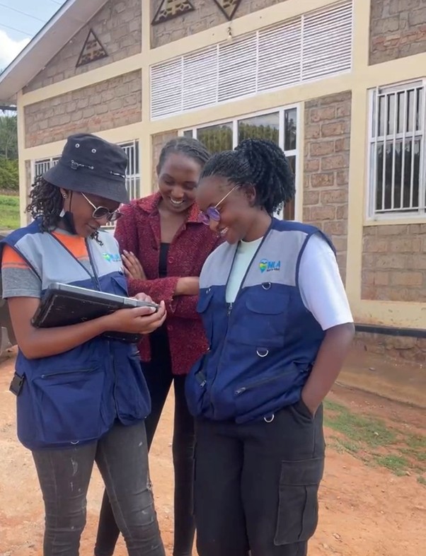
An ABF project Grant has funded a training workshop in Nairobi to build community capacity for Inclusive Land Governance.
Dec 2025
The recently concluded GIS & Land Literacy Training Workshop, held from 13th–15th October 2025 at CTI Center Nairobi, brought together community leaders, students, civil society actors, and local stakeholders for an intensive three-day capacity-building program. Supported by the Aubrey Barker Fund (UK) and facilitated by Nicholas Saoke, the workshop focused on empowering underserved communities through spatial data skills and inclusive land governance approaches.
The training aimed to strengthen participants’ abilities in digital mapping, spatial analysis, and participatory land decision-making. Through practical sessions and group discussions, attendees learned how to collect, interpret, and apply spatial data in addressing land access, land rights, and community advocacy challenges. The workshop also emphasized gender and youth inclusion, encouraging diverse participation in land governance processes.
Participants reported significant skill gains in GIS tools, digital mapping workflows, and collaborative land management practices. The sessions fostered meaningful links between academia, government agencies, and community-based organizations—laying the groundwork for stronger partnerships in promoting transparent and ethical land governance.
Overall, the workshop was highly successful, achieving its intended outcomes and inspiring participants to apply their new knowledge in driving equitable land access and improved community planning. The positive energy, engagement, and commitment displayed throughout the event demonstrate a growing readiness to use spatial data for social transformation across Nairobi’s informal settlements and beyond.
(December 2025)
Research report funded by the Aubrey Barker Fund conducted by The Association des Jeunes Experts sur les Questions Foncières (AJEF), Cameroon.
The Aubrey Barker Fund awarded a grant of £1,000 to the Association des Jeunes Experts sur les Questions Foncières (AJEF), a civil society organisation (CSO) based in Cameroon, to organise a seminar in Yaoundé in August 2025.
The seminar brought together 30 selected researchers and practitioners, who gained practical and career-enhancing skills in agile land project management with the Rapid Planning Toolkit, as well as in powerful writing and professional communication. Full report can be downloaded below.
At the Aubrey Barker Fund, we remained committed to investing in people who will shape the future of land governance.
Publication of a Research Study funded by the Aubrey Barker Fund and conducted in Cameroon by Mr. Marcel Loyd MINKA
In August 2023, Mr. Marcel Loyd MINKA received 1200 £ (pounds) from ABF (Aubrey Barker Fund) to sponsor his research study on Participatory Mapping for Land Boundary Conflicts mitigation in Mbalmayo, Cameroon. Mr. Minka started this research study in June 2023 and due to lack of sufficient funding from June 2023 to July 2023, his research study did not move forward. But thanks to the funding received from ABF in August 2023, Mr. Minka was able to complete his research study in October 2023. The following year, Mr. Minka submitted a full research paper manuscript on this study, and this study was successfully published by the International Journal of Social Science and Human Research under their special issue of December 2024.
This study was published as a research paper under the title “Assessing the Contribution of Participatory Mapping Data Collection Methods in Detecting and Mitigating Land Boundary Conflicts on Farm Areas: A Methodological Framework”.
To access this paper, use this link https://ijsshr.in/v7i12/62.php
Mr. Minka is a Ph.D. Researcher at the Department of Animal, Nutrition and Food Sciences (DiANA) of the Faculty of Agricultural, Food and Environmental Sciences at the Università Cattolica del Sacro Cuore. His research focuses on “Mitigating land conflicts and securing farmers’ land rights through improved participatory mapping”. In 2022, Mr. Minka received a Ph.D. Scholarship from the ‘De Africa’ project, financed by the Italian Episcopal Conference’s Service for Charitable Interventions in the Third World at the Università Cattolica del Sacro Cuore, to pursue a Doctor of Philosophy in Agri-food System (Sustainable Agriculture through effective Land Tenure Security).
In the above research paper, Mr. Minka talks about the fact that Land conflicts are a significant and sensitive issue in Africa, and these land conflicts are a serious threat to agricultural productivity. In the abstract of his paper, Mr. Minka notes that now our days there exist several methods of land data collection which facilitates land conflict mitigation, and each of these methods are been explained in various papers. However, none of these papers have compared these methods to bring out their unique contribution as a means to assist practitioners in identifying land conflicts prone areas. His research is centered around the question: what is the distinctive contribution of each land data collection methods in identifying land conflict prone areas during participatory mapping? Using a case study of three villages in Mbalmayo (Cameroon), his research adopts an approach that combines farmland data from interviews, questionnaires, consultative meetings, field visits, demarcation of farm boundaries; recording of Ground Corner Points using Catalyst DA2, UAV flights, and participatory mapping. In his paper, Mr. Minka discuss the usefulness and limitation of each method, highlighting their unique contribution to the holistic understanding of the context of Mbalmayo and the mitigation of land conflicts. His study was conducted from June to October 2023. The results of his analysis shows that amongst the eight methods used to collect farmland data, six of these methods had a distinctive contribution that facilitated the mitigation process by precisely identifying the land boundary conflicts zones. The ideas provided by his paper can serve as guidelines for researchers and practitioners interested in mitigating land conflicts through participatory mapping approaches.
You can also access this paper using Copernicus through the link https://journals.indexcopernicus.com/search/article?articleId=4149736
ABF awards Bursary to Ryan Benade of Namibia for Master's Research
ABF has awarded Ryan Theodore Benade a tuition and registration bursary to undertake his Master’s in Spatial Sciences at the Namibia University of Science and Technology under the supervision of Professor Oluibukun Gbenga Ajayi.
This award continues a chain of generational mentorship: Professor Ajayi, too, was an ABF bursary recipient during his PhD studies at the Federal University of Technology, Minna. This demonstrates the Fund’s commitment to sustaining professional networks and capacity building in land management. The continuity reflects ABF’s ethos of long-lasting impact through educational support and knowledge sharing across generations of surveyors and spatial scientists.

Namibia’s agricultural potential is constrained by soil degradation, uneven fertilizer application, and limited spatial soil data, which together impede sustainable crop production. Ryan’s project entitled “Mapping Soil Macronutrients Using Multi-Spectral Remote Sensing and Machine Learning” addresses these challenges by predicting the spatial distribution of Nitrogen (N), Phosphorus (P), and Potassium (K) across key farming regions in Namibia. The study will generate continuous surface maps of soil fertility, enabling targeted interventions and optimised land use by fusing ground-sampled nutrient measurements with high-resolution spectral information from Sentinel-2 and Landsat 8.
The ABF bursary will cover a significant portion of his tuition and registration fees, freeing Ryan to dedicate his attention to research activities, field sampling, and data analysis without financial constraints. The expected decision-support tools, like the nutrient distribution maps and predictive models, will empower Namibian farmers and land managers to implement variable-rate fertilisation, thus reducing input waste and minimising nutrient runoff in alignment with UN Sustainable Development Goals 2 (Zero Hunger), 9 (Industry, Innovation and Infrastructure), 12 (Responsible Consumption and Production), 13 (Climate Action), and 15 (Life on Land).
Before 2025
Development of an integrated automatic image registration scheme
Oluibukun Ajayi (pictured above) reports on his PhD project: The Aubrey Barker project grant was awarded for the successful completion of my project which is part of a doctorate degree in Surveying and Geoinformatics at the Federal University of Technology, Minna, Nigeria in May 2018. The title of the funded research is ‘Development of an integrated automatic image registration scheme’ and it is aimed at developing an integrated model for the automatic registration of overlapping images captured from a drone with a view to optimising the process of tting images to existing maps. The grant was spent on eld work which consisted of hiring of equipment, such as the DGPS receivers used for the establishment of Ground Control Points (GCPs) and the Check Points (CPs), hiring of the Phantom 4 drone used for the image data acquisition, hiring of a project vehicle, payment of site allowances for eld/research assistants, beaconing of GCPs and CPs and marking them with re ective materials. Three different methods of describing features were integrated with epipolar correlation in the development of an optimised automatic image registration scheme. The developed algorithms were implemented using JAVA scripts and tested using the drone images in two different registration campaigns. Degraded images with poor spatial resolution and a small size were used for the rst campaign while images with excellent resolution, but of large size, were used for the second campaign.

In the course of this research, a novel integrated automatic image registration algorithm based on epipolar correlation was developed which proved to be more robust (with respect to speed and accuracy) than the automatic image registration algorithms that are based on selected conventional feature descriptors. The novel registration algorithm integrates both the geometric and epipolar constraints which makes it more robust in terms of accuracy and speed (processing time). Finally, an automatic image registration software which contains a stereo comparator and a module for automatic camera calibration was developed for easy implementation of the developed algorithms. The developed registration scheme will be of particular interest to the military, cartographers, radiologists, digital photogrammetrists and remote sensing experts as a tool for educational, training and industrial applications